Usage | Setting | Result |
|---|---|---|
Berthing |
| Annotations are displayed but the OBSTRN feature is hidden.
|
Harbour |
| Annotations and the OBSTRN feature are displayed.
|
Approach |
| Annotations are displayed but the OBSTRN feature is hidden.
|
Annotations can be added to features in source. The files that are required to create annotations in source are the same as those required to create annotations in paper charts.
Features with representations on multiple usages may need different cartographic attribute values. For each usage, the $ovrid attribute on the annotation feature can be used to hide the annotated feature, allowing only the annotation(s) to be displayed. The attribute is set on the annotation feature and not on the feature itself.
$ovrid is an enumerated attribute that can set to 0 ‑ Do not hide or 1 ‑ Hide.
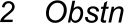
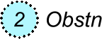
For example, an OBSTRN (obstruction) feature is represented across three usages: Berthing, Approach and Harbour.
The feature is annotated separately on each usage. Two annotation features are related to the represented OBSTRN feature:
• $sound is a cartographic sounding
• $genam is general name, in this case, “OBSTRN”
This table demonstrates how the $ovrid attribute on an annotation feature affects the display of the annotated feature.
Usage | Setting | Result |
|---|---|---|
Berthing |
| Annotations are displayed but the OBSTRN feature is hidden.
|
Harbour |
| Annotations and the OBSTRN feature are displayed.
|
Approach |
| Annotations are displayed but the OBSTRN feature is hidden.
|